
Communication Builds Our Community
Communication Builds Our Community
Series of Strong Systems Expected to Bring Repeated Rains - After-School Activities Cancelled
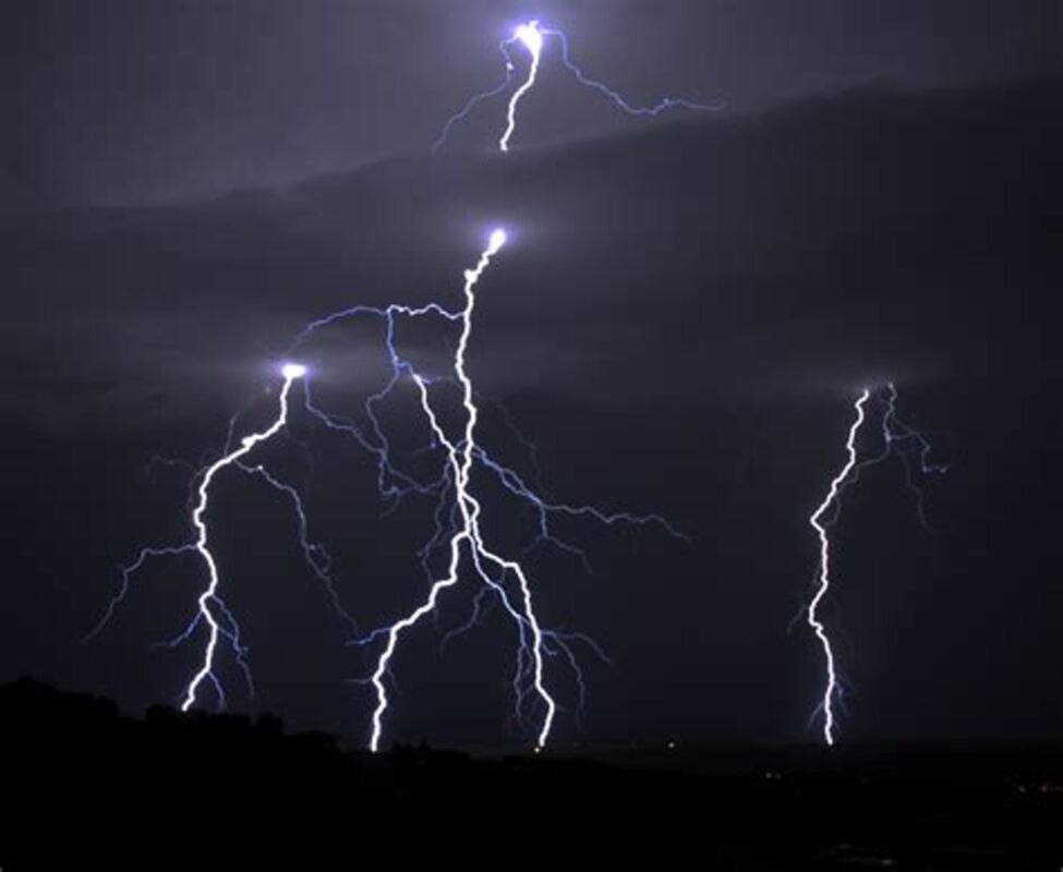
A strong squall line with potentially-damaging wind guests is expected to pass over the Lake Wales Ridge on Tuesday evening. Lighting strikes and the slight chance of tornadoes is also forecast.
A slight risk of tornadoes across Florida will be a repeated feature of a series of strong El Nino storm systems expected to impact the state in coming days and weeks. The squally weather is typical of winters when the Pacific phenomenon impacts weather across North America.
The wild swings of weather seen in central Florida in recent days is expected to continue this week with a dash of severe threats thrown into the mixture, as the long-predicted El Nino weather pattern takes hold here.
The immediate concern is for Tuesday evening, when a strong, fast moving squall line is expected to pass over the Lake Wales Ridge with the potential for damaging winds. Cloud to ground lightning and a slight risk of tornadoes has been forecast as well. Residents are urged to monitor weather conditions and take shelter as the squall line approaches around dusk.
The Polk County School Board has ordered the cancellation of all after-school activities Tuesday due to the anticipated inclement weather.
The pattern of repeated rainy fronts is due to a powerful, low-level southern jet stream, which will be carrying winds stronger than 70 miles per hour Tuesday. That river of wind continues to direct powerful low-pressure systems across the US and the deep south.
Saturday's frontal passage left widespread totals of more than an inch of rain across the area, but none of the tornadic activity which impacted Fort Lauderdale later that afternoon.
Following the expected rains Tuesday, the area can expect a couple of days of drier weather, before yet another strong system approaches on the weekend. Long-range models indicate that the pattern may continue for weeks.
The generally-welcome rainfall to start the new year is a contrast to 2023, which saw extended periods of dry weather and few of the typical summer thunderstorms that normally fill the local aquifers. Rainy, stormy El Nino winters have been experienced in Florida many times.
In February 1998 an El Nino triggered the state's deadliest tornado outbreak, when an outbreak along the I-4 corridor killed 42 people, and caused 259 injuries. Some 15 tornadoes were recorded in that event.
The El Nino weather phenomenon is a well-documented pattern of water temperature changes in the Pacific Ocean that affects weather globally. The once-reliable oscillation has become wildly unpredictable in recent years.


Reader Comments(0)