
Communication Builds Our Community
Communication Builds Our Community
Coldest Temps of the Season Behind Us? Stay Tuned During Wild Winter Swings
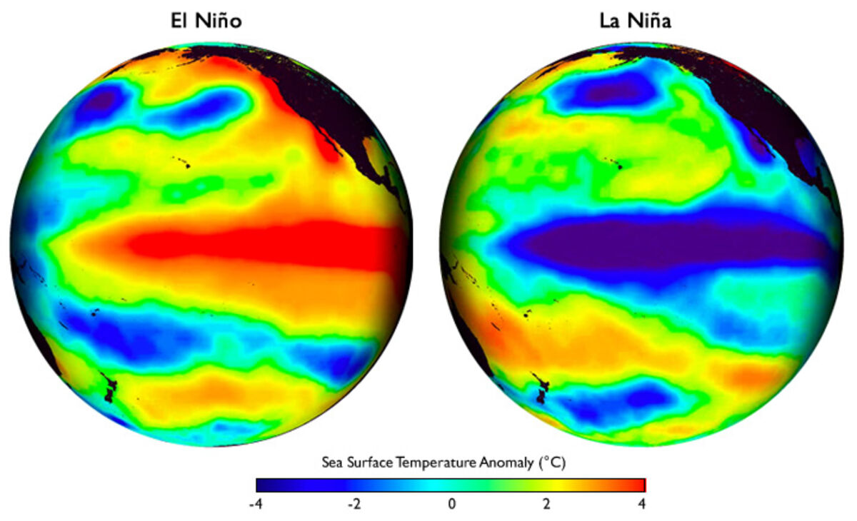
The sharp differences between the temperatures in the Pacific Ocean seen in these images explains the driving force of the La Niña / El Niño cycle.
After weeks of rainy weather, accompanied by wild swings in temperature, a more stable near-term outlook is becoming established for Florida and most of the southern United States.
A series of Pacific high-pressure systems are expected to replace the parade of arctic air masses that put much of the nation, and central Florida, under below-normal temperatures in recent days.
Although we escaped freezing temperatures on the Ridge, residents are ready for a warm-up, and that's what they should get according to long-range forecasting models. Those same models are also predicting low rainfall chances despite the El Niño weather pattern that has so far dominated the season.
El Niño is a condition of the Pacific Ocean featuring westerly winds that push warm surface water toward the coast of the Americas and away from Asia and the Pacific islands. That warm mass releases moisture-bearing warmth, causing wetter-than-normal winters across much of the south, along with higher chances of severe weather outbreaks such as those experienced across Florida over recent weeks.


Reader Comments(0)