
Communication Builds Our Community
Communication Builds Our Community
Forty-Six Others serve Balance of County
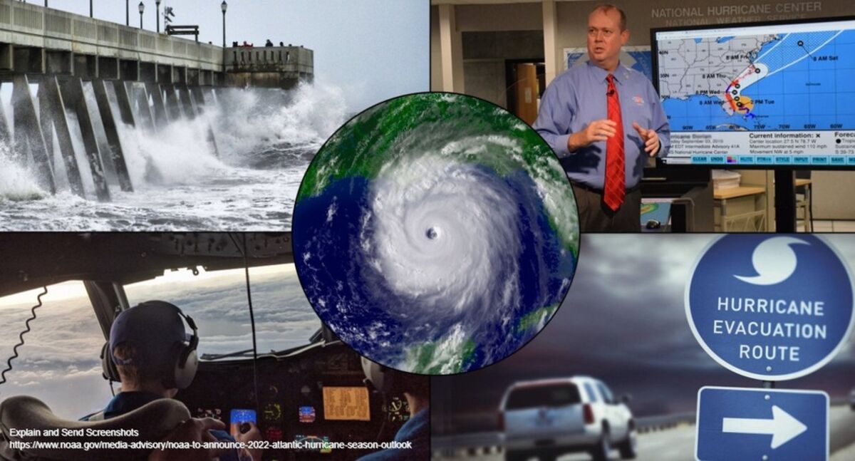
Hurricane season 2022 is right around the corner. Residents are urged to be prepared.
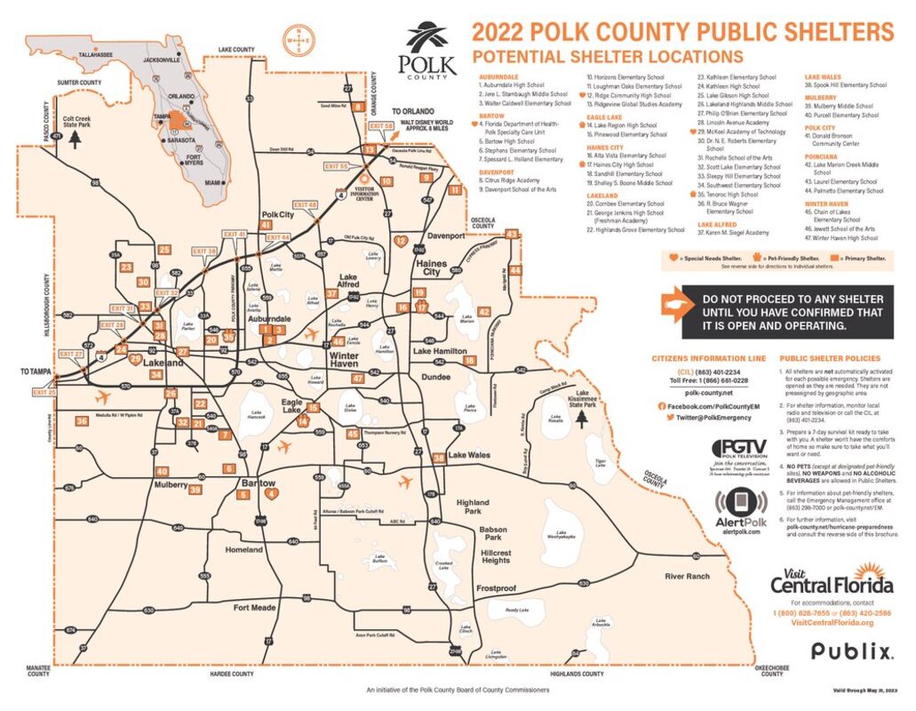
The Polk Hurricane shelter map shows an absence of shelters for much of the southeast county.
As the 2022 Hurricane season begins, a map of Polk County Public Shelters shows that of the 47 shelters listed, only one is located in southeast Polk County, an area stretching east of US 27 and south of Waverly Road from Lake Kissimmee Sate Park to the Highlands County line, and including a population of more than 80,000.
Spook Hill Elementary School is the only public shelter for the vast area, which has also previously hosted waves of refugees fleeing storms threatening the Florida east coast.
An attempt to reach Polk County Emergency Management about the situation led to an unmonitored phone and a full voice mailbox. An effort to reach an alternate phone number led to an answering service for Polk County Sports Marketing and the Auburndale Chamber of Commerce, .
The 2022 map includes 47 shelters, and designates three "Special Needs Shelters" for residents with Medical or physical conditions that require special assistance. Those are located in Bartow, Davenport, and Lakeland. Pre-registration for these shelters is highly recommended, by contacting Polk County Emergency Management (PCEM) at (863) 298-7027.
According to the press release accompanying the map, three shelters are designated "Pet Friendly." They are limited to accepting dogs, cats and birds. Specific requirements apply at "Pet Friendly" shelters, so those needing shelter are asked to check those requirements in advance.
The public shelters maps are to be made available at Publix Super Markets in Polk County by the end of May, and area lodging facilities and chambers of commerce will also have maps on hand in the event of a storm..
It should be noted that not every shelter may be opened during a particular storm, so evacuees are advised to call a number printed on the map to confirm that a specific shelter has been opened before traveling to it.
"In the event a Hurricane threatens Central Florida, we will work closely with our accommodations partners to determine the supply of available rooms. This information is critical in helping evacuees find lodging," said Mark Jackson, director of Polk County Tourism and Sports Marketing (PCTSM). PCTSM relays this vital information to Polk County Emergency Management (PCEM) and area lodging facilities. PCEM uses this data to decide when and where to open shelters once area accommodations reach capacity. Evacuees can then be directed to open shelters using the map, which lists shelter locations and directions. The map also provides sources of emergency information, important telephone numbers and a list of recommended items to include in a "7-Day Survival Kit."
Polk Emergency Management recommends sheltering in place as the primary option during a disaster, and suggests that you plan to be self-sufficient for at least seven days during and after a disaster. You should anticipate no water, electrical power or utilities for that period of time. Public shelters should be the option of last resort, according to officals. In the event you decide you need to evacuate to a shelter, they strongly suggest that you bring a "7-Day Survival Kit" with you. Once in a shelter, you may not be permitted to leave until an all-clear is issued.
For information about emergency preparedness in Polk County, you are invited to visit http://www.polk-county.net/em.


Reader Comments(0)