
Communication Builds Our Community
Communication Builds Our Community
Storm Now Features 100 mph Winds as it Aims for Big Bend
The path of Idalia will keep it well west of the Tampa Bay area, and minimize impacts locally.
The chance of severe weather from Hurricane Idalia is dropping rapidly this evening as the storm continues on a steady northward track, now advancing at 16 mph. Precautions are still advised for possible gusty winds and heavy rains overnight but the storm center is expected to stay well away, moving nearest to Florida's Gulf Coast overnight but remaining some 200 miles west of the Pinellas County coast.
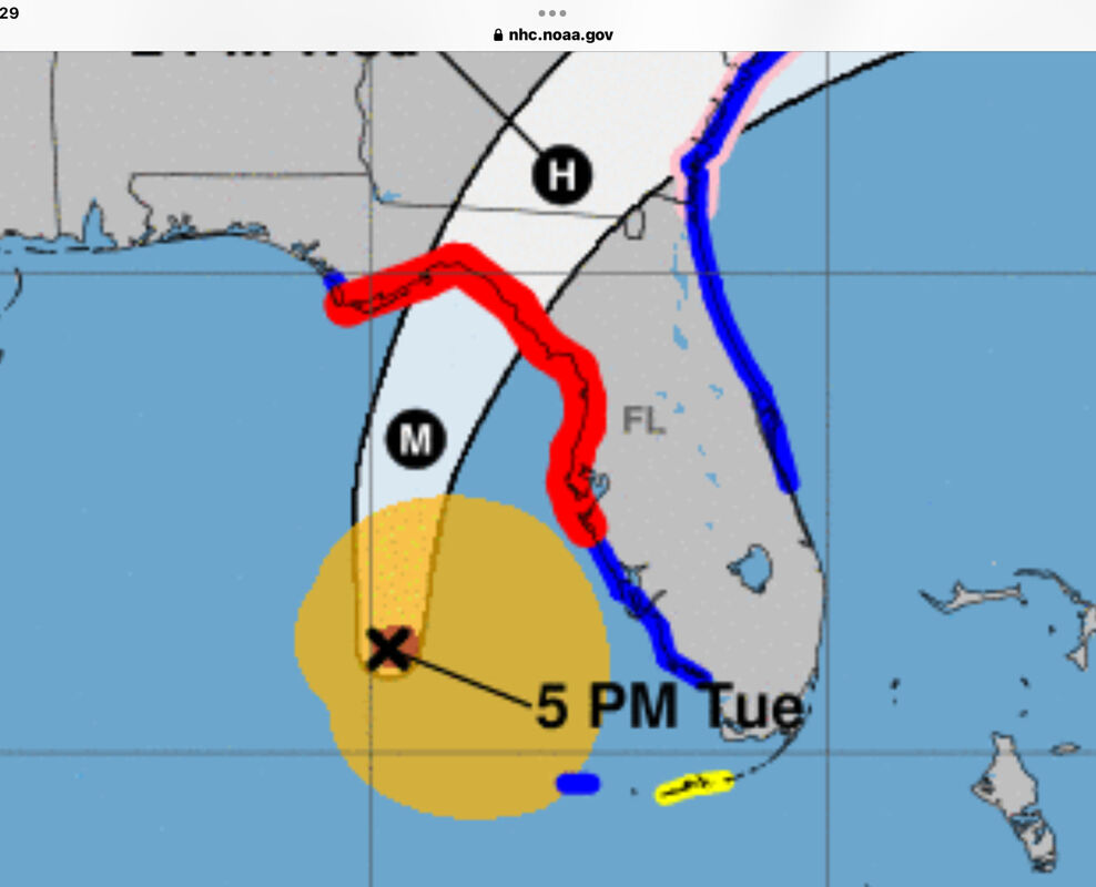
The 5:00 pm update from the National Hurricane Center in Miami actually shows a westward line of travel for the storm, which indicates that the center of the storm is still on course for the Big Bend area of Florida north of Cedar Key, which will receive the worst of the storm and the accompanying storm surge, which could rise more than 12 feet above normal tide levels.
Any increased eastward adjustment in the course would raise the potential impacts of the storm in the east Polk County area, but that is increasingly unlikely given the forward speed of the system.
Radar tracking and Hurricane hunter reports indicate that an eye is beginning to form as the intensity of the storm increases. The central barometric pressure of the storm has dropped to 972 millibars, or 29.71 inches of mercury, indicating a stronger convection. Winds have strengthened to 100 mph, and are expected to reach 115 mph or more overnight before making landfall tomorrow morning.
Polk County schools, Lake Wales Charter Schools, and Polk State College, along with many other area institutions, will be closed tomorrow. The Charter schools and colleges are expected to operate normally on Thursday.


Reader Comments(0)