
Communication Builds Our Community
Communication Builds Our Community
Two Models Showing Potential for Development Around November 18
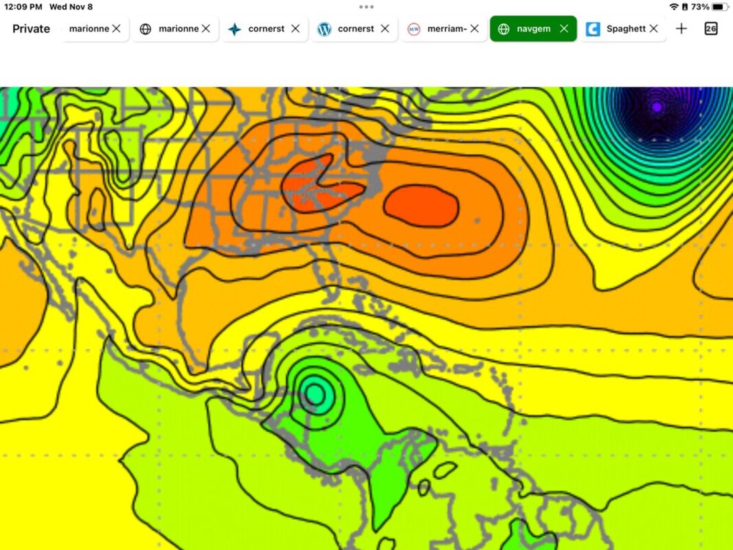
The Navgem forecast model is depicting a tropical system developing in the western Caribbean near the coast of Honduras and Nicaragua. Seasonal development in the Caribbean and Gulf of Mexico is occasionally the source of Florida-bound storms.
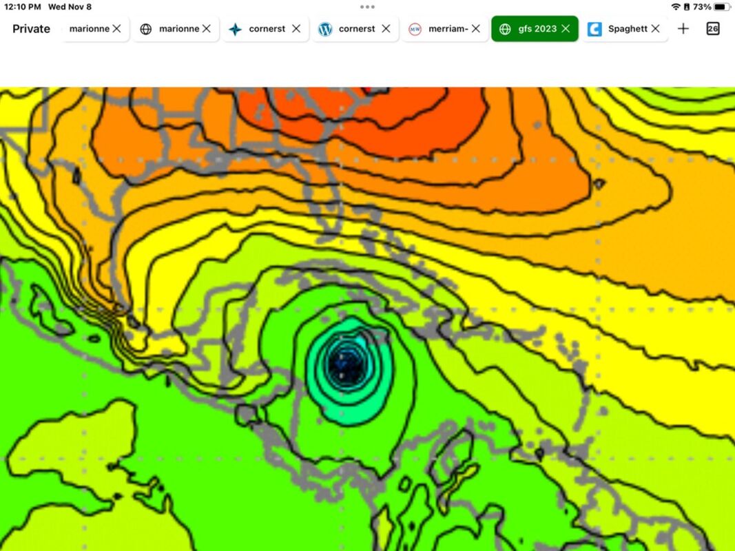
A second model, the usually reliable GFS, shows a stronger system in the Caribbean but slightly farther east and closer to Jamaica. Any storm to form in the area would be slow to move northward due the blocking ridge of high pressure depicted by both models.
Even as the Lake Wales area enjoys pleasant and mild weather, it's important to keep a weather-eye out for late-developing tropical storms and hurricanes that could threaten to disrupt our idyllic autumn days. Now two long-range models are depicting just such a potential.
Hurricane season runs through November 30, and there have been occasional storms that have developed even after that date. The unusually-warm water in the Atlantic basin, coupled with unseasonable warmth, has left the door ajar for further development.
Two models shared by the Florida State University supercomputer ensemble are now showing the possible development of a late-season storm or, potentially, Hurricane, in the western Caribbean Sea.
The Navgem model is showing a storm developing very near the coast of Nicaragua and Honduras. A second model, the usually reliable GFS, shows a stronger system in the Caribbean but slightly farther east and closer to Jamaica. In either scenario, such a storm could pose a potential threat to Jamaica, Cuba, the Yucatan Peninsula of Mexico, the Bahamas, and Florida, as well and the entire northern Gulf coast.
The National Weather Service in Miami issues outlooks for seven day periods, and the model depictions remain outside that time frame, so the NHC remains silent as to the potential at this time. Any storm to form in the area would be slow to move northward due the blocking ridge of high pressure depicted by both models.
Area residents are always advised to have a storm plan and emergency supplies available in case of unexpected conditions. LakeWalesNews.net will continue to monitor the models and provide updates if necessary.


Reader Comments(0)