
Communication Builds Our Community
Communication Builds Our Community
Hyperactive Storm Season Forecast by NOAA, Computer Models
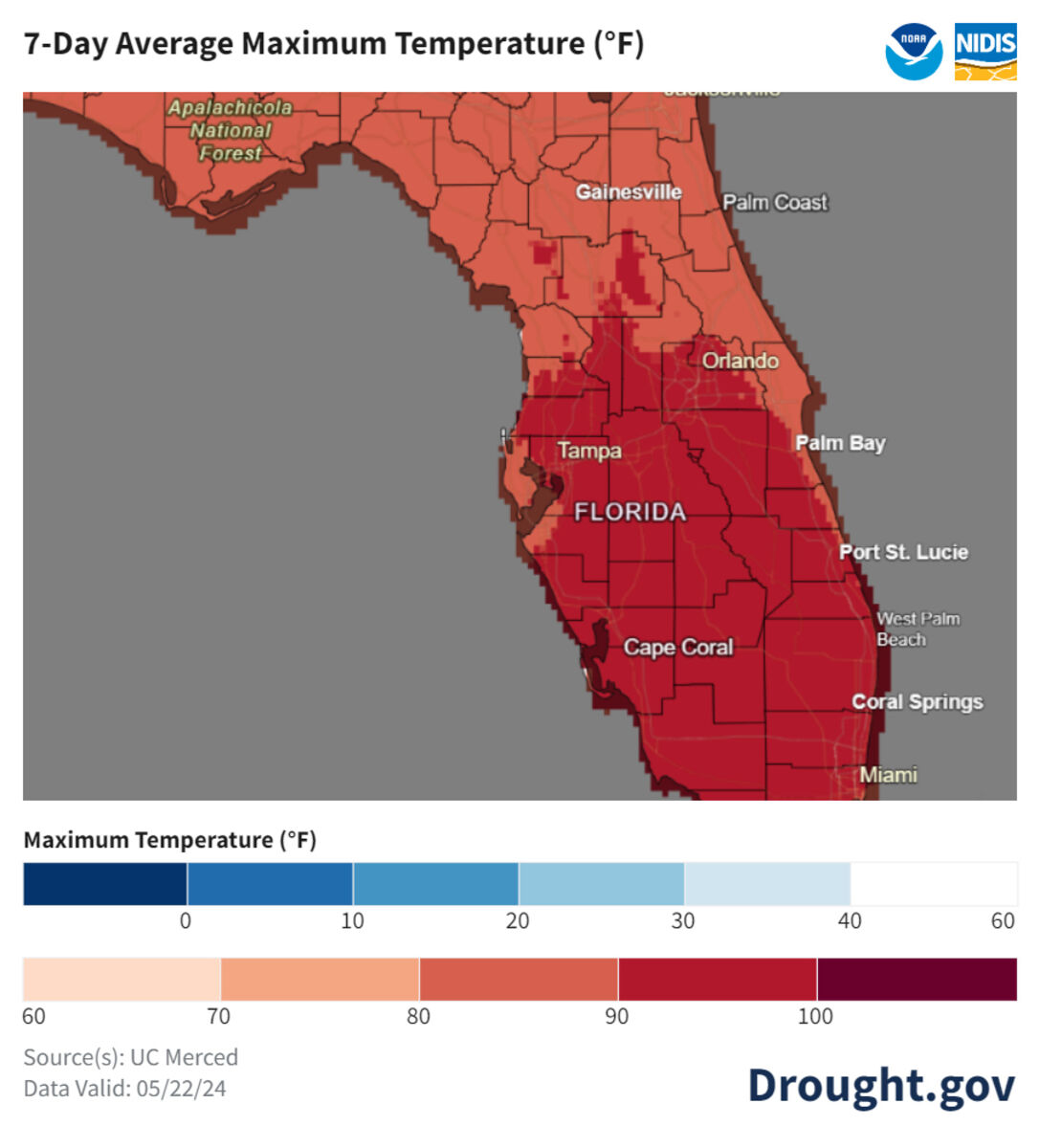
Temperatures for the coming seven days are forecast to rise into dangerous levels for outdoor activities.
The drought and intense heatwave that has gripped the Ridge and most of central Florida has led Polk County to declare an outdoor burn ban which will go into effect next week. The move comes just as the 2024 Hurricane season begins.
The annual six-month cyclone season is predicted to be far more active than normal by the National Oceanic and Atmospheric Administration (NOAA) and a host of private weather predictions.
NOAA's Climate Prediction Center has released a forecast that includes 17 to 25 named storms, of which eight to 13 will be hurricanes. Four to seven of those may become major hurricanes, a level well above a typical Hurricane season.
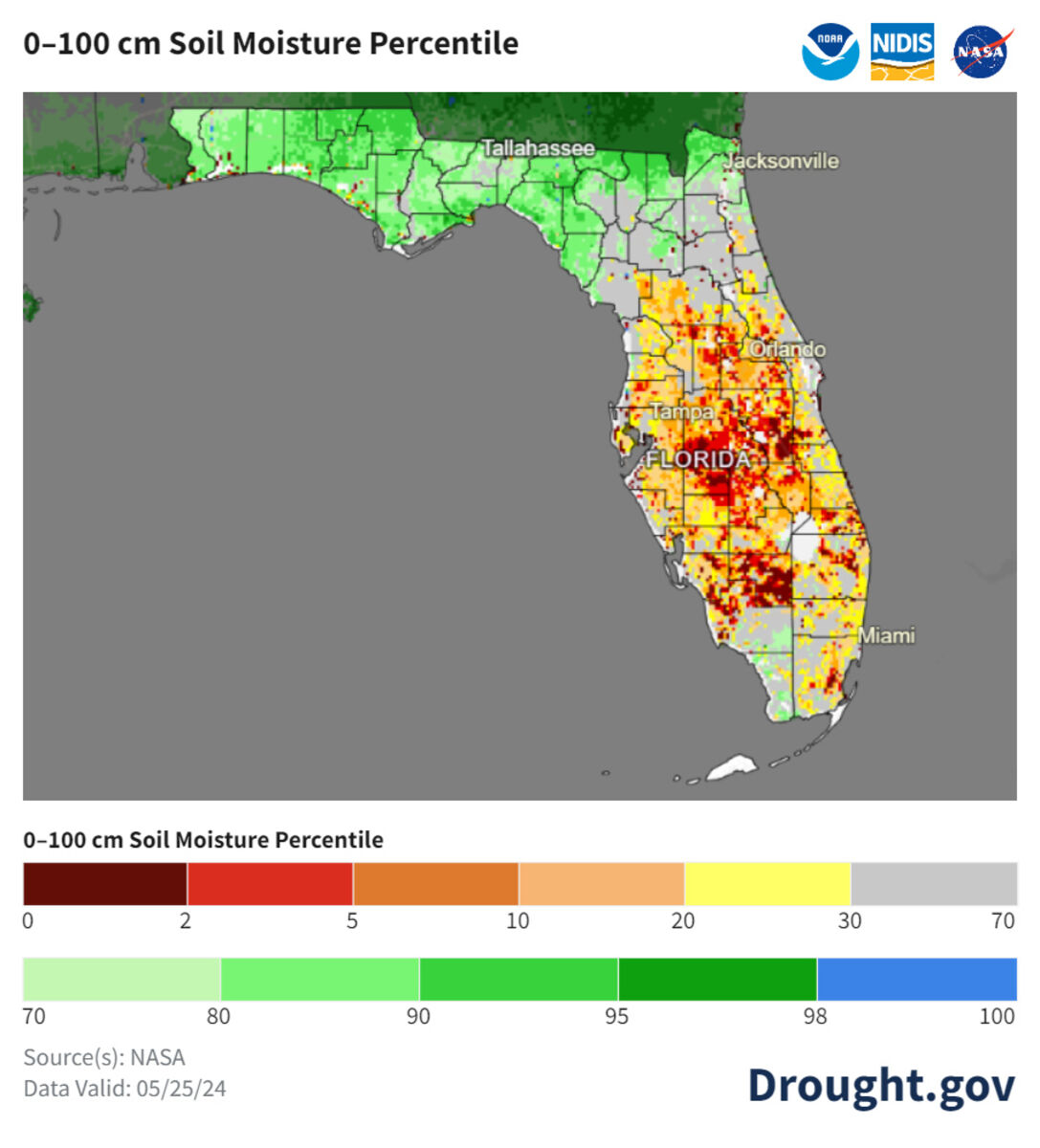
Current soil conditions to a depth of 100 centimeters (39.37 inches) shows excessive dryness across the Lake Wales Ridge area.
NOAA forecasts are based upon a factor of heat known as Accumulated Cyclone Energy (ACE). That heat, stored primarily in the oceans, currently range from 150% to 245% of the median.
A team of scientists including the renowned Dr. Michael Mann at the University of Pennsylvania forecast a range between 27 and 39 storms, leaving a best-estimate of 33 named storms.
Much of the expected increase in storm frequency and intensity in the predictive models is due to the end of the El Niño conditions that marked last year's season. The opposite La Niña effect, in which cool water pools in the eastern Pacific, normally reduces the strong upper-level currents that "shear" young hurricanes apart, tilting and eventually separating the layers of swirling winds.
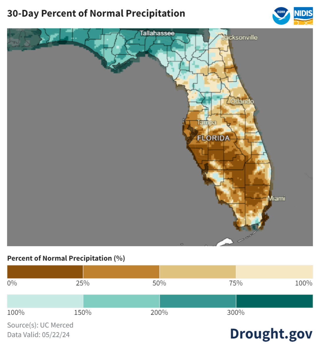
The rainfall forecast for the coming month continues to show totals well below seasonal norms. The area's rainy "monsoon" season normally begins around June 1.
Meanwhile, the Lake Wales Ridge area remains in the grip of drought, forecast to worsen. Outlooks for the coming weeks shows an expected rain deficit, while soil moisture levels are well below normal, in places only five to ten percent of expected conditions. Florida's normal summer thunderstorm rains are powered by a sprawling high-pressure system that typically parks over the Atlantic, pumping moisture-laden air from the Caribbean northward across the state. That set-up has yet to materialize.
The combination of events has caused some to remark on the extremes that have marked the area's climate in recent years. While winters typically saw occasional freezing temperatures as low as 25°, the Ridge has not seen temperatures lower then 35° in several years.


Reader Comments(0)