
Communication Builds Our Community
Communication Builds Our Community
After a soggy end to May, Floridians are looking forward to the June 1 start of Hurricane season with a sense of trepidation. A rash of hurricanes in recent years has many still facing the costs of cleanup and repair, while along the coasts, many homes remain wrecks.
According to forecasters, the upcoming season is likely to once again be "above average," although average has become a moving target. Most models are reflecting that, given sea-surface temperature closer to normal, the 2025 season should be less than apocalyptic unless, of course, you find yourself in the path of a major storm.
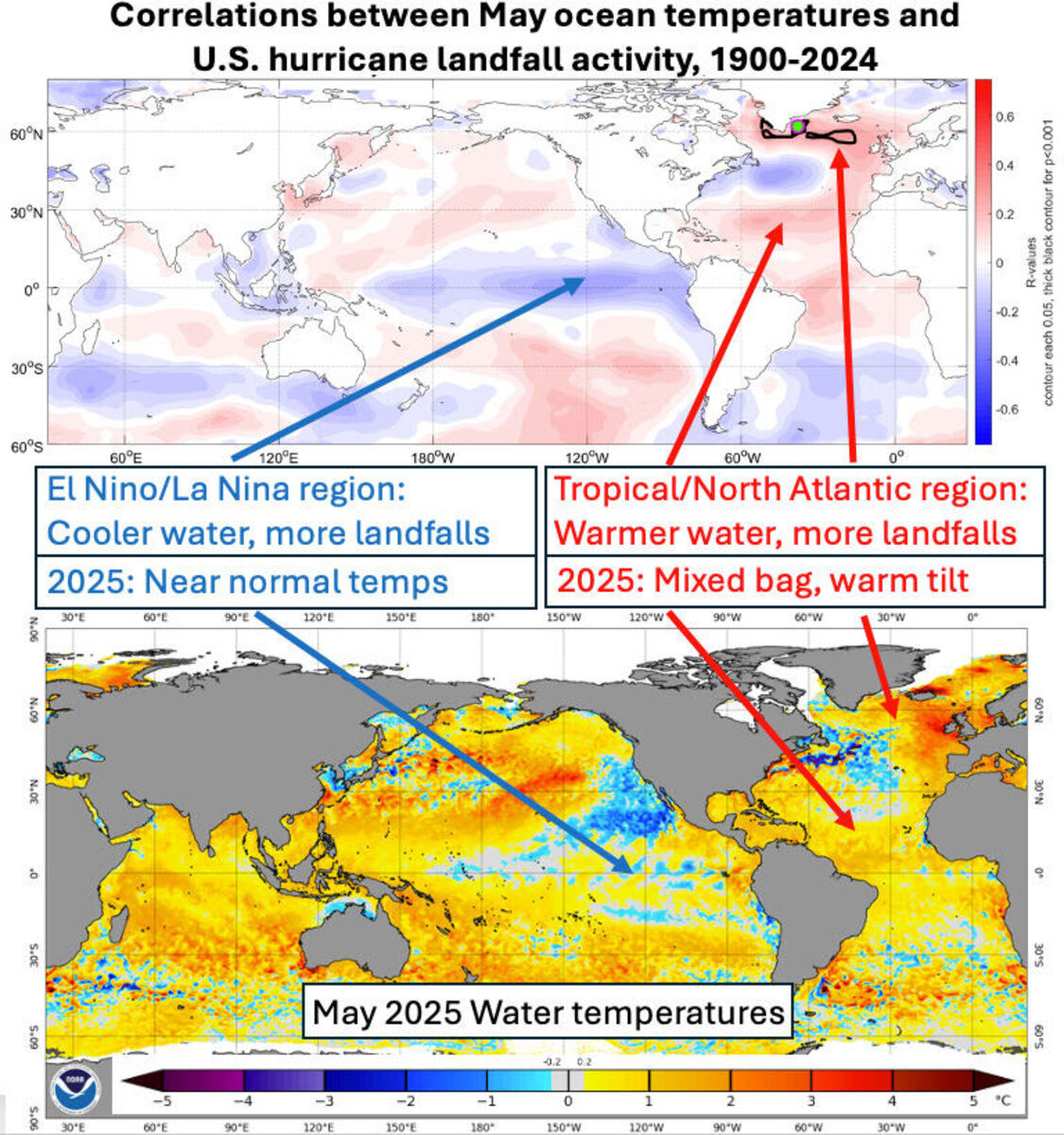
More moderate, although still elevated, sea-surface temperatures in the Atlantic basin offer hope of a less active hurricane season in 2025. The season begins Monday and runs through November 30.
As the season begins, some models, including the GFS, are already hinting at potential development of a disturbance in the western Caribbean. If that forms, it is likely to move northward toward Cuba.
Jet stream models are also reflecting the development of a strong surface low in the Caribbean that could move toward the Sunshine State.
Soils in the Lake Wales Ridge area have received rounds of heavy rains in most locations over recent days, but those came on the heels of an extended spring-time drought, so soil moisture is only now approaching normal levels.
In the near term, a late-season cool front will be drifting back northward after passing southward Saturday morning.
After a pleasant evening and early morning, moisture will return to the area on Sunday afternoon and rain chances will remain high over the next several days. Collisions of sea breezes from the Atlantic and Gulf will be the main drivers of thunderstorm activity.


Reader Comments(0)